Escorted Tours along with Relocation Service
About Belize
Overview:
Belize was the site of several Mayan city states until their decline at the end of the first millennium A.D. The British and Spanish disputed the region in the 17th and 18th centuries; it formally became the colony of British Honduras in 1854.
Constitution and Government:
Belize achieved full independence on September 21,1981. It is now a member of the British Commonwealth, the United Nations and the Non-Aligned Movement. Diplomatic relations have been established with many countries. Belize is also a member of the Caribbean Community (CARICOM) and related institutions.
The Government of Belize is operated on the principles of parliamentary democracy based on the Westminster system. A Prime Minister and Cabinet make up the executive branch, while a 28-member elected House of Representatives and eight- member appointed Senate form a bi-cameral legislature. Her Majesty Queen Elizabeth 11 is the titular [Head of State] and is represented in Belize by a Governor-General, who must be a Belizean.
Population:
307,899 (July 2009 est.)
Ethnicity:
Mestizos 48.7%, Creole 24.9%, Maya 10.6%, Garifuna 6.1%, other 9.7%
Languages:
Spanish, Creole, Mayan dialects, English (official), Garifuna (Carib), and German
Geography:
Area 22,963 sq km (8,866 sq. miles) slightly larger than Massachusetts. Belize borders the Caribbean Sea along the eastern shore of Central America just below the Yucatan Peninsula. It is bounded on the north by Mexico and on the west by Guatemala.
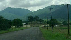
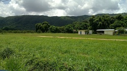
There is a low coastal plain, much of it covered with mangrove swamp, but the land rises gradually towards the interior. The Maya Mountains and the Cockscomb Range form the backbone of the southern half of the country, the highest point being Victoria Peak (1000 meters) in the Cockscomb Range. The Cayo District in the west includes the Mountain Pine Ridge, ranging from 305 to around 914 meters above sea level. The northern districts contain considerable areas of low tableland. There are many rivers, some of them navigable for short distances by shallow-draught vessels. A large part of the mainland is forest.
The climate is sub-tropical, tempered by easterly trade winds. Temperatures in coastal districts range from about 10*C (50*F) to about 35.6*C (96*F); inland the range is greater. Rainfall varies from an average of 1,295 millimeters in the north to 4,445 millimeters in the extreme south. The dry season usually extends from February to May and there is sometimes a dry spell in August.
Religions:
Roman Catholic 62%, Protestant 30% (Anglican 12%, Methodist 6%, Mennonite 4%, Seventh-Day Adventist 3%, Pentecostal 2%, Jehovah's Witnesses 1%, other 2%), none 2%, other 6% (1980) - again for all of Belize. Ambergris has a larger percentage of Roman Catholics.
Currency and Banking:
The currency unit is the Belize Dollar (Bz$). The fixed rate of exchange is Bz. $2.0 to US $1.0 There are four commercial banks (the Belize Bank Ltd., Barclays Bank PLC, the Bank of Nova Scotia and Atlantic Bank Ltd.), and a Government Savings Bank. Recent amendments to the Banking Act permit offshore banking.
Tourism:
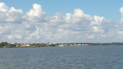
Belize is blessed with the second largest barrier reef in the world, three of the four atolls in the Caribbean, a large network of caves on land and in the sea, a wide variety of animals-including the endangered Jaguar, 500 species of birds and colorful flora and fauna. Over 600 Maya ruins, many rivers and a small easy-going and harmonious multiracial society characterizes this Caribbean country in Central America.
Roads:
Belize has four major highways, the Northern Highway connecting Belize City with Chetumal on the Mexican Border, the Western Highway connecting Belize City with the capital, Belmopan, and continuing to the border with Guatemala, the Southern Highway linking the Stann Creek and Toledo Districts and the Hummingbird Highway. All principal towns and villages are linked by roads to Belmopan and Belize City.
Regular bus services operate to and from all main towns.
Inland Waterways:
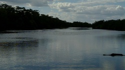
Several rivers and lagoons are navigable by shallow draught vessels. The Belize River is used for logging.
Air:
The main airport, Phillip S.W. Goldson International Airport, is situated 10 miles from Belize City, and is owned and operated by the Government. The runway, at present 7,100 feet long, can accommodate large, wide boded jet aircrafts. Regular international services are maintained by six airlines to and from the United States of America, Central America and Mexico. There are numerous, government owned or privately licensed airfields suitable for light and twin-engine aircraft. Domestic air services provide connections to all main towns and three of the main offshore islands. A modern weather radar system, part of the World Meteorological Service, gives early warning of approaching hurricanes. The Belize Weather Bureau is now equipped with satellite communication facilities to assist in weather forecasting.
Sea:
The main port is Belize City, now equipped with a modem deep-water port able to handle container shipping. Nine major shipping lines move cargo to and from Belize to Central and North America, Europe and Japan. The second largest port, Commerce Bight just south of Dangriga, has been improved to accommodate the medium sized vessels required to handle increased exports of bananas and citrus products.
Coastal services are operated between towns and villages on the mainland to some of the offshore islands, and to Puerto Barrios in Guatemala.


